
Directions:
From 210 freeway exit Baseline Road
Travel West 0.1 miles to Padua Ave Turn Right
Travel North 1.8 miles to Mt. Baldy Road Turn Right
Continue on Mt. Baldy Road for 8 miles passing through Mt. Baldy Village
Where the Road forks continue straight onto Ice House Canyon Road
From 10 Freeway exit Monte Vista Ave
Travel North on Monte Vista, it will turn into Padua Ave above the 210 freeway
Travel North 1.8 miles to Mt. Baldy Road Turn Right
Continue on Mt. Baldy Road for 8 miles passing through Mt. Baldy Village
Where the Road forks continue straight onto Ice House Canyon Road
View Larger Map
Cucamonga Peak is the Eastern most peak on the San Gabriel Range. Standing at 8856 feet, it is a massive figure on the backdrop of the Inland Empire. This article will discuss reaching the peak from Ice House Canyon from Mt. Baldy Village. For a detailed description on Ice House Canyon and reaching Ice House Saddle please take a look the Ice House Canyon article.

This hike should be attempted sometime in the Summer or Fall before the first snow fall. A good portion of the trail is shielded from the sun and snow and ice could be a problem into late spring. The trail to the peak is narrow and steep in places and it is best to avoid snow and ice, especially if you are with your pup.


Once you reach Ice House Saddle, you will be faced with a number of different trails. If you turn to the left you can proceed to Timber Mountain and the Three T's. If you turn right you can continue to Kelly Camp and Ontario Peak. If you continue straight you will journey to Lytle Creek. The path to Cucamonga Peak is to the right of the Middle Fork Trail. You will notice you are climbing up hill. If you are travelling downhill, then you are most likely on the Middle Fork Trail. From the saddle it is around 2 and a half miles to the peak. So make sure you are prepared to continue. If you or your dog are showing signs of fatigue, now would be a good time to turn back.


The next 2 miles all take place above 7000 feet on steep and narrow trails. Be prepared! Be sure you have enough water for you and your dog. Be prepared to deal with the gusts that whip through the canyons. Be sure to check the forecast to make sure there are no weather advisories. And have some food to replenish you and your dogs energy for the return journey.

The beginning of your journey from Ice House Saddle will take you around the slopes of Bighorn Peak. As you wind around the slopes you will eventually reach Cucamonga Saddle. From here you will begin your ascent up to Cucamonga Peak. The switchbacks will help you climb the peak and you will gain elevation rapidly.


As you ascend, be sure to enjoy the views. Although challenging, this is a very enjoyable trail with many sights to see along the way.


Be sure to bring enough water for your pup. The climbing will present quite a challenge for your furry friend. This is not a good hike if your dog is not in good shape. Be sure to take them up to Ice House Saddle and maybe up to Timber Mountain a few times before you embark on this journey. If your dog is in good condition they should really enjoy this journey. But the last thing you want to do is to have to carry a dog downhill for six miles. There were a couple other dogs that Hunter encountered on the Peak, but I would reserve this trip for only the well-conditioned trail dogs.

When you reach this sign (the sign has seen better days) continue up the trail to Cucamonga Peak. You are almost there! You are litterally just feet away. Just continue going up toward the peak and not past this sign on what looks like another trail.
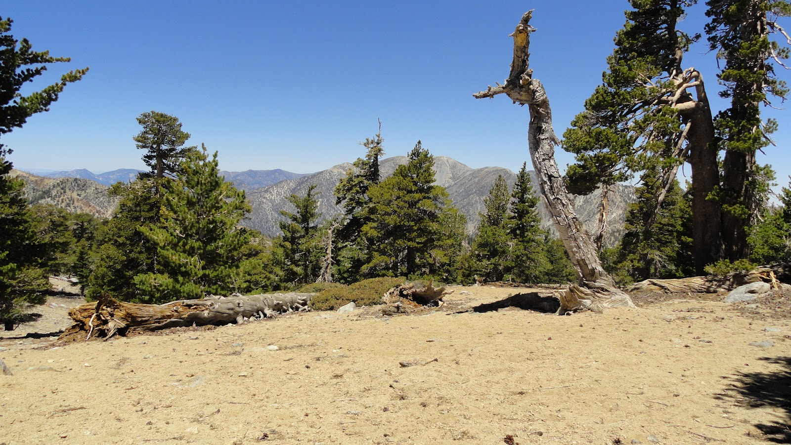
Once you are on the peak, you will notice that there is a lot of flat ground. The official peak and high point are just beyond, but be sure to explore the whole surrounding area. You will be treated to some great views and a number of cool conifers. There are also a large number of lizards and birds to see. Just watch for ants.


The views from the Peak are spectacular. On a clear day you may be able to make out the silohuettes of Downtown Los Angeles. Plan to spend extra time on the peak to enjoy the views that range for miles and miles. The views make this hike extra rewarding. These views may be even more rewarding than a hike up Mt. Baldy or hiking the Three T's. It's also fun to take the time to see if you can recognize any landmarks from 8800 feet!


I suggest you spent at least an hour to rest, rehydrate and have a snack on the peak before you return journey. The trek downhill can put some strain on your knees. Return the way you came feeling accomplished. Every time you travel through the Inland Empire you can look up at the peak and remind yourself that you made it up there!
Elevation Gain: 3800 feet
Distance: 12 miles round-trip
Difficulty: Strenuous
Time: Around 7 hours total
Required Permits: Cucamonga Wilderness Permit, Forest Adventure Pass
Where to Obtain Permits: Mt. Baldy Visitor Center (In Mt. Baldy Village 909-982-2829) If you want to hike before 8 a.m. call the day before for a Wilderness Permit. Buy a Forest Adventure Pass
Dog Approved: Yes! But, be sure they are in good shape!
Wonderfull , greeting from Belgium
ReplyDelete